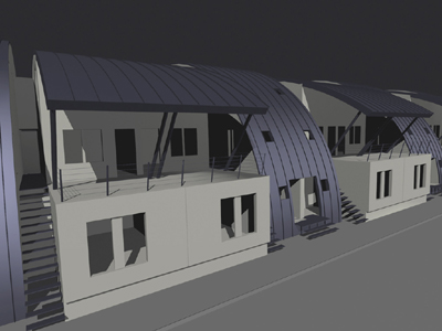
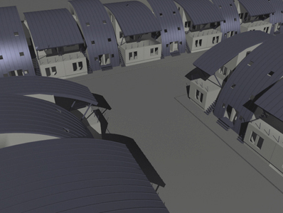
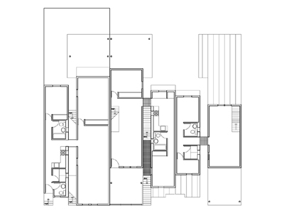
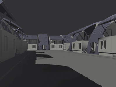
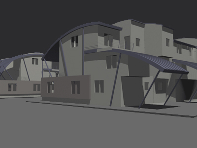
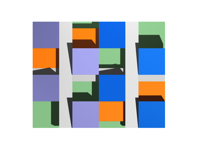
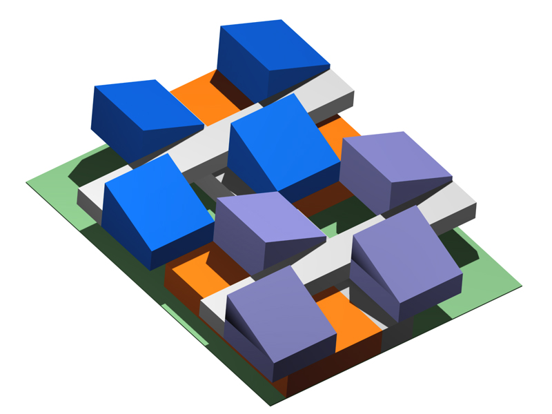
Prototype
|
|
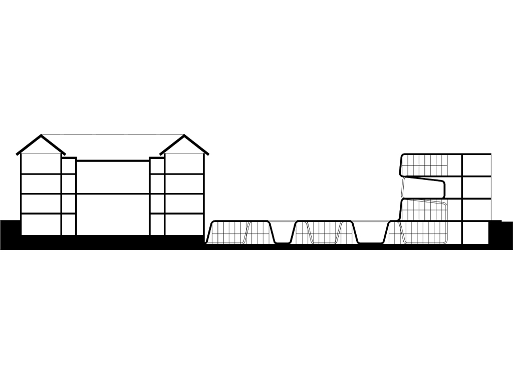
The neighborhood needs a community to thrive. Community is the mutual flow of information. Information needs a voice to be heard. Voices need spaces to speak. Since the lot is the site, at least two units are needed per site for a local community to exist.The front porch and rear yard, as local community spaces are connected via a slot which bisects the site and doubles as a light well for the interior service spaces. The rear set back will initially be a semi-public yard for use by the block and later, could be vehicular access to the units. The front porch is raised one level above grade to establish a semi-private status for the local community space. This event is articulated on the front and side elevations with panels of brick. Continue reading Prototype… |
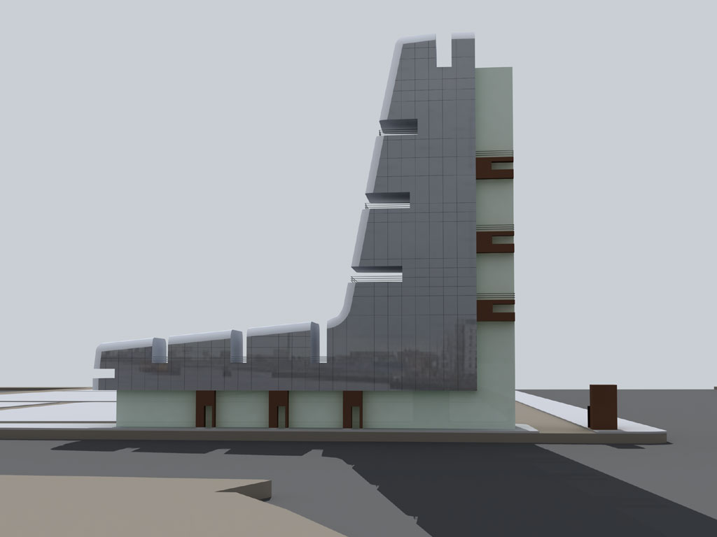
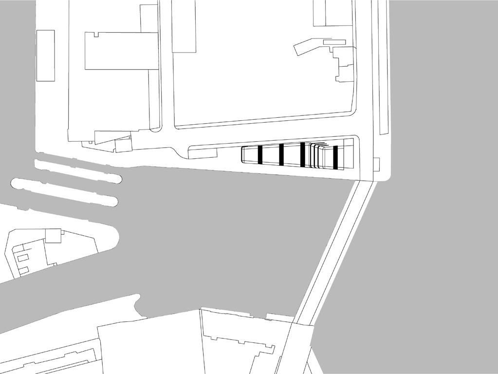
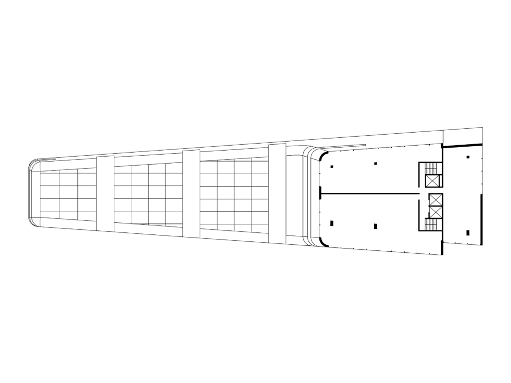
Canal Side
|
|
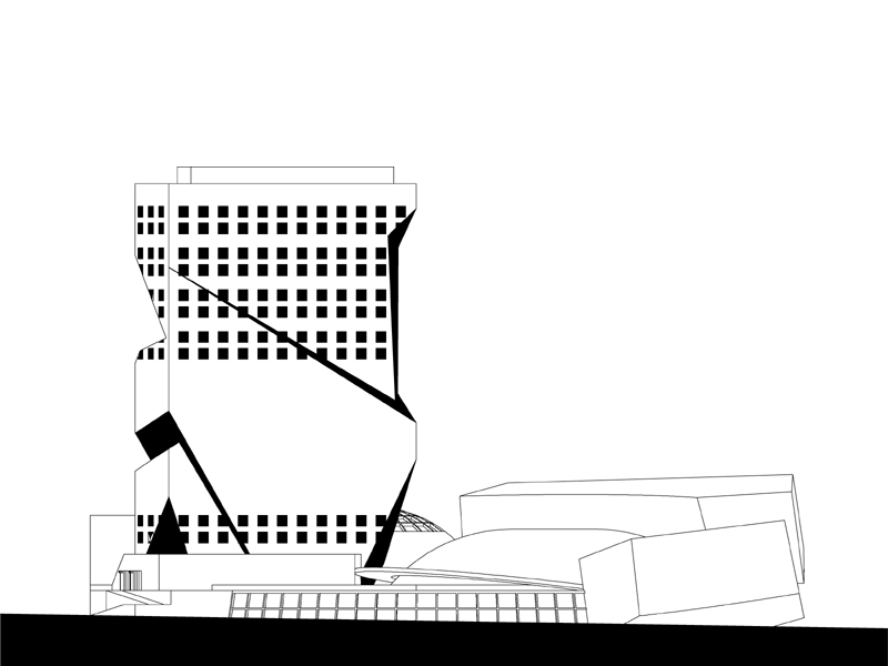
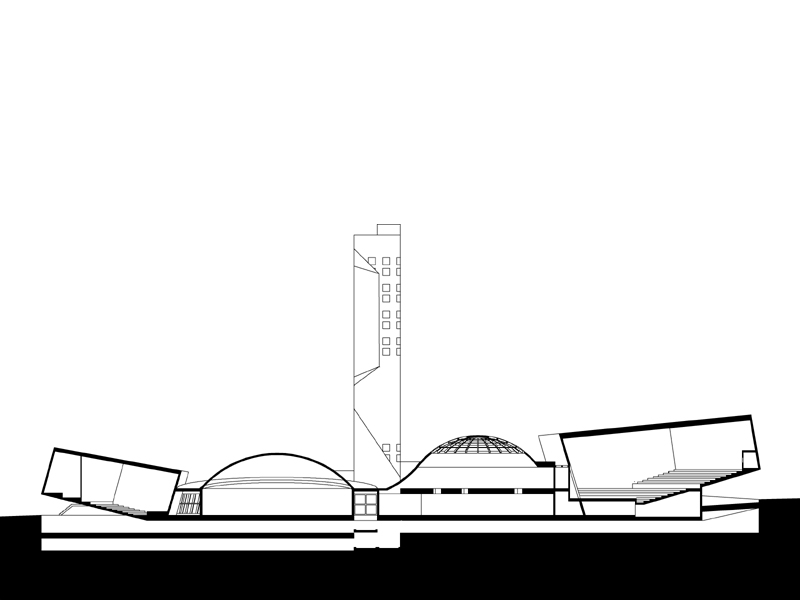
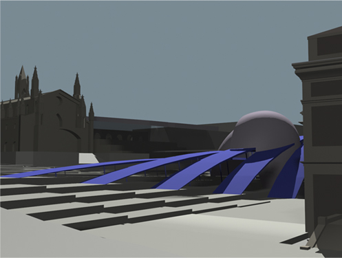
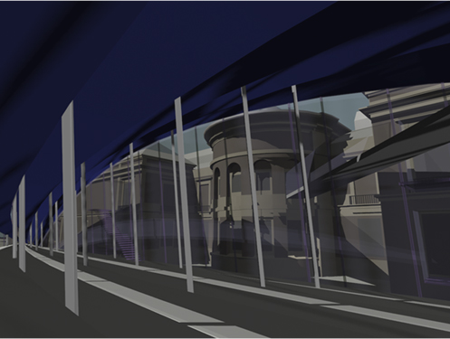
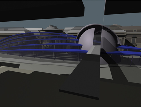
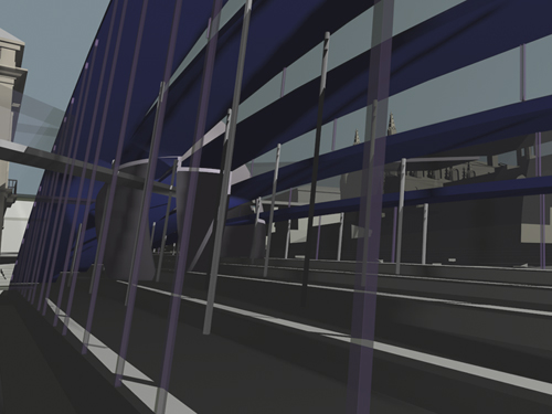
The existing water’s edge at the intersection of the two Quay’s form two axes of an apparent and powerful Cartesian grid: the x and y axes. This proposal establishes the third: the z axis. Through formal symmetry, a plane is created by the x-z axes or the east elevation of the building. This strategy is used to connect to and resolve the large scale of the bodies of water. It locates the intersection of the rivers within the city and presents a metaphoric gateway to the Docklands. This is achieved by treating the ground (x axis) and the northern edge of the building (z axis) in a similar way. Leading to an apparent uniformity between the platform and tower elements. Continue reading Canal Side… |
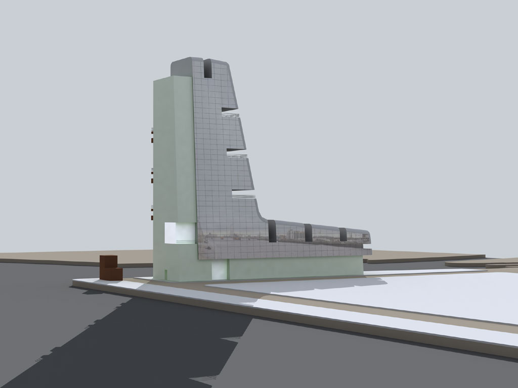
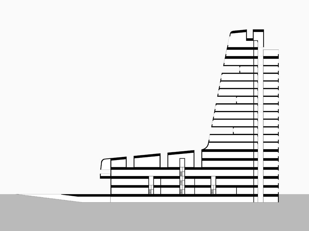
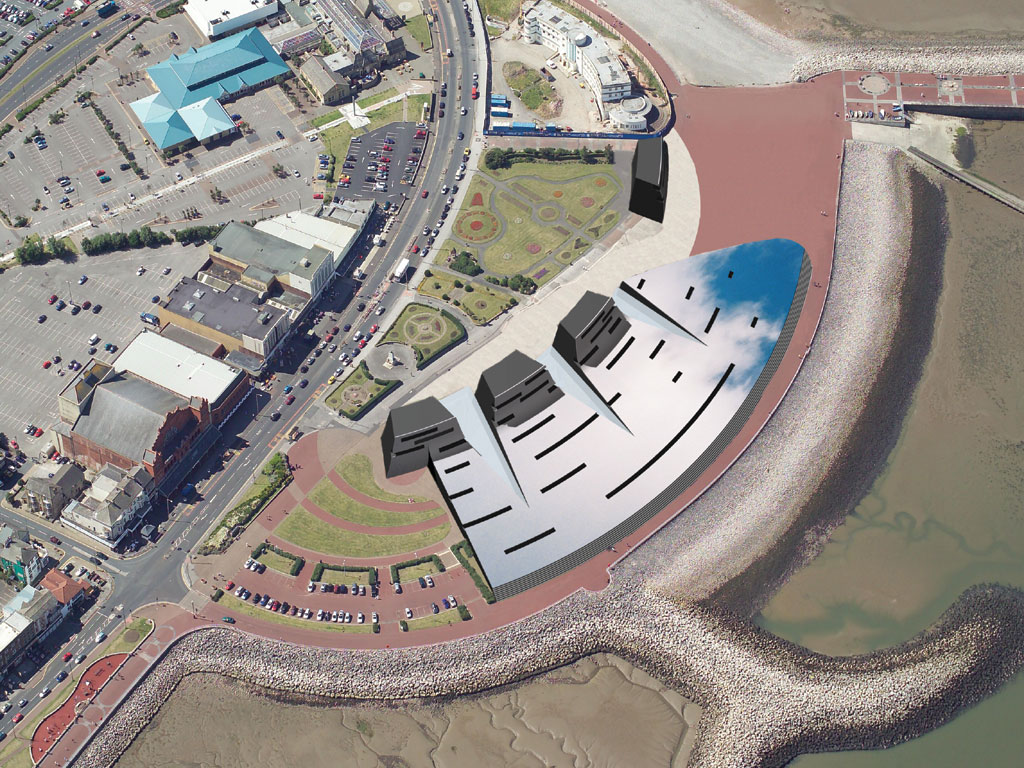
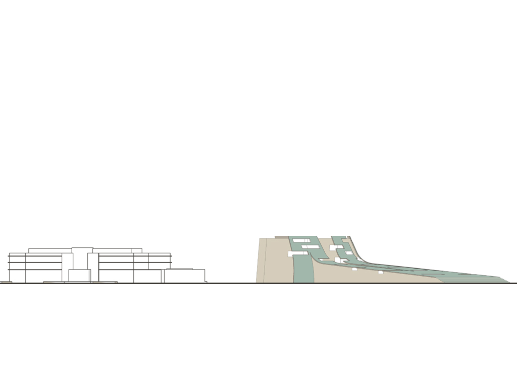
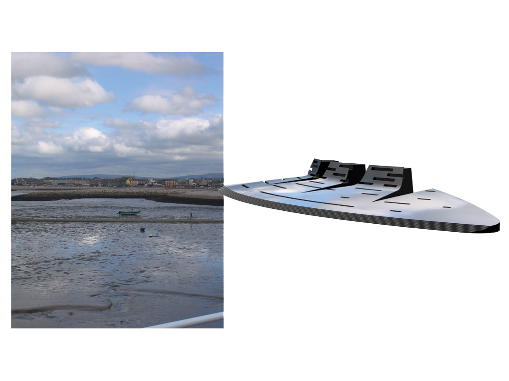
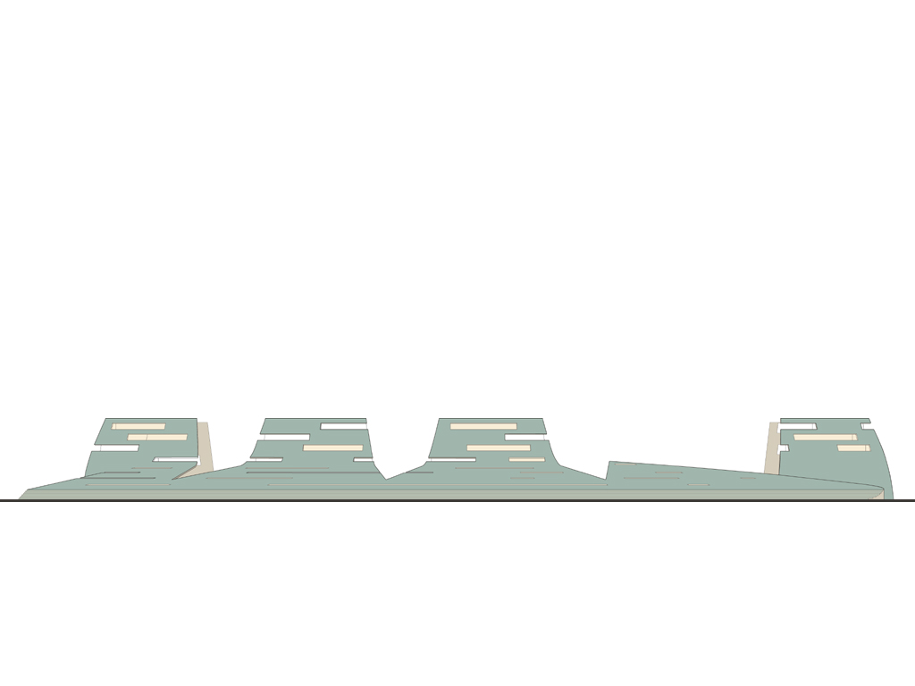
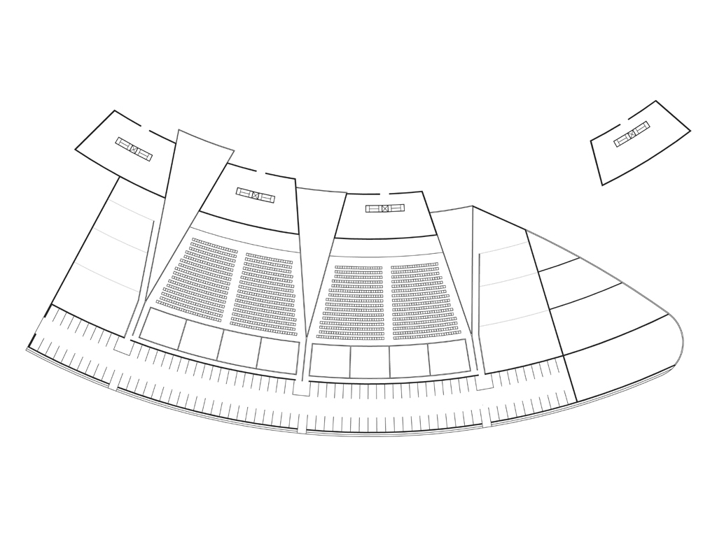
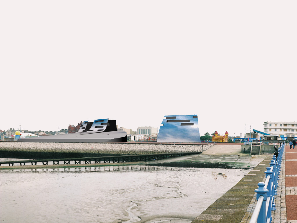
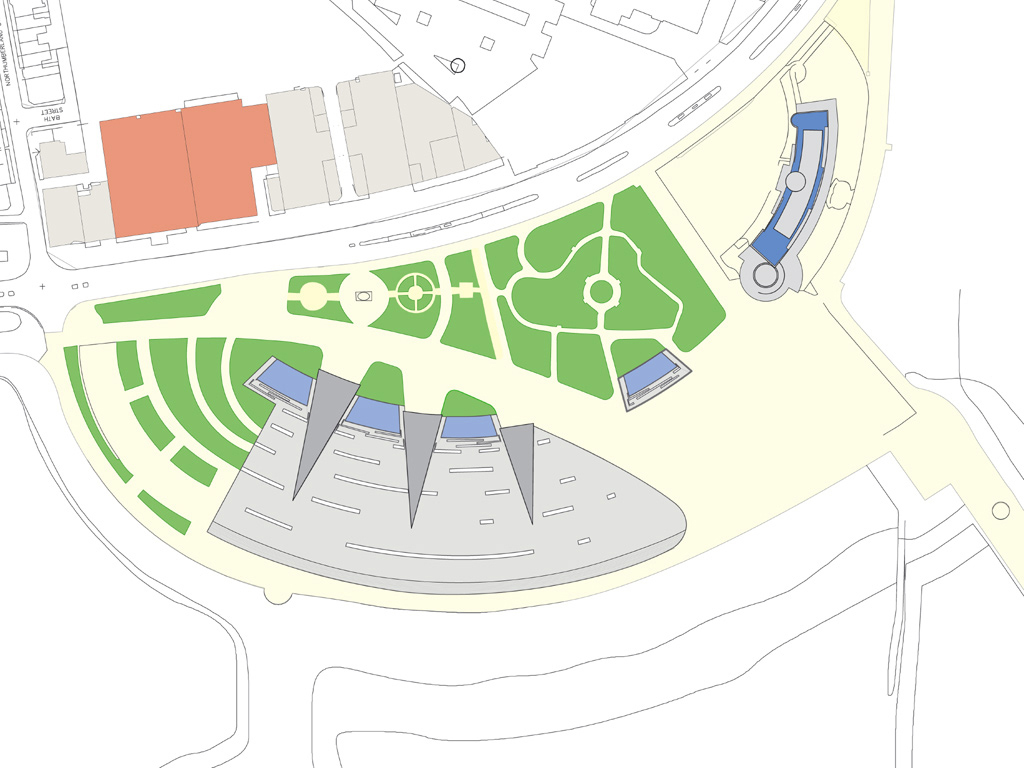
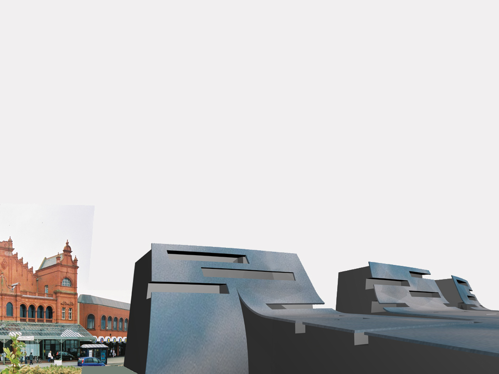
Ocean Front
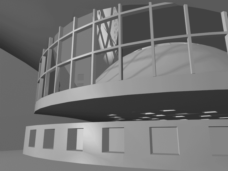
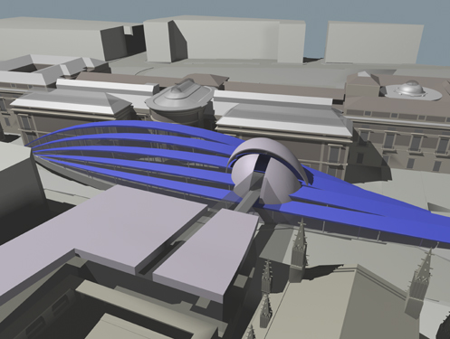
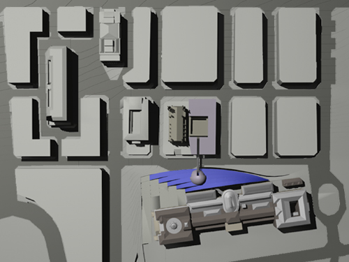
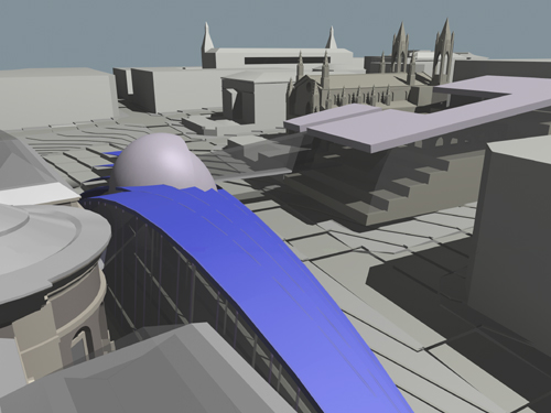
| The title “Reflections on Music and Life” is a literal description of the idea of the work. Located at one of England’s more striking natural phenomena; Morecambe Bay is a tidal estuary with extensive mud flats. As the tide recedes a vast area of sandy mud is revealed as a flat reflective surface. The roof and façade of the Music venue extends this reflective surface. The phenomenon is extended onto the work; what ever natural image is reflected by the mud will be reflected by the building.The Midland Hotel is one of the resorts “thoroughly modern” landmarks and curves to embrace the view of the Bay. This planning geometry is used as a context for the work; the venue’s auditoria are curved to fit the landform. |
|
|
| Continue reading Ocean Front… |
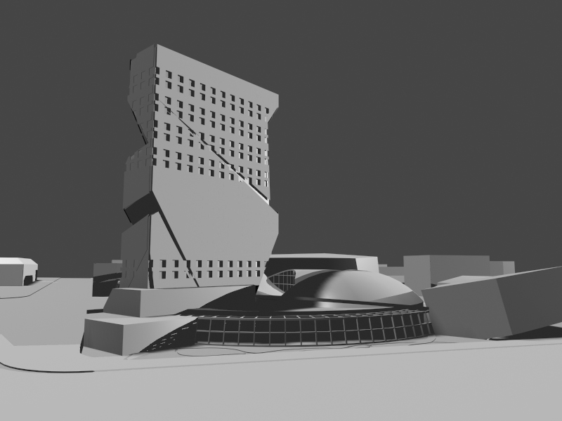
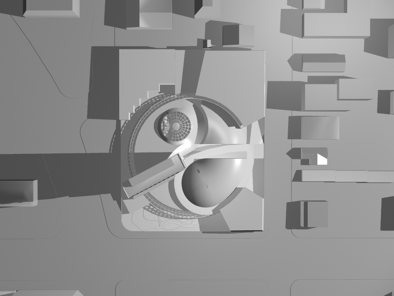
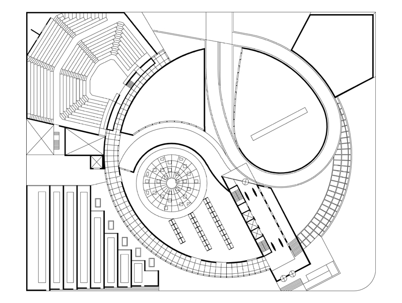
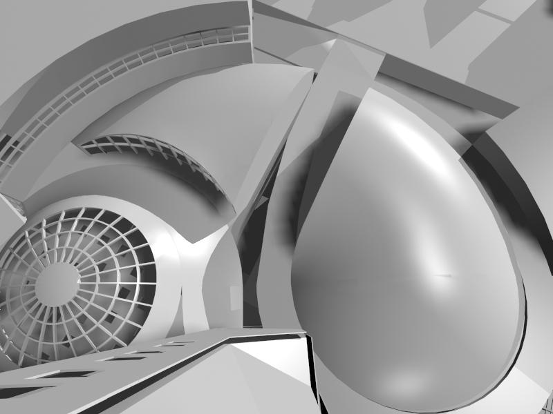
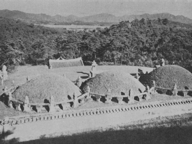
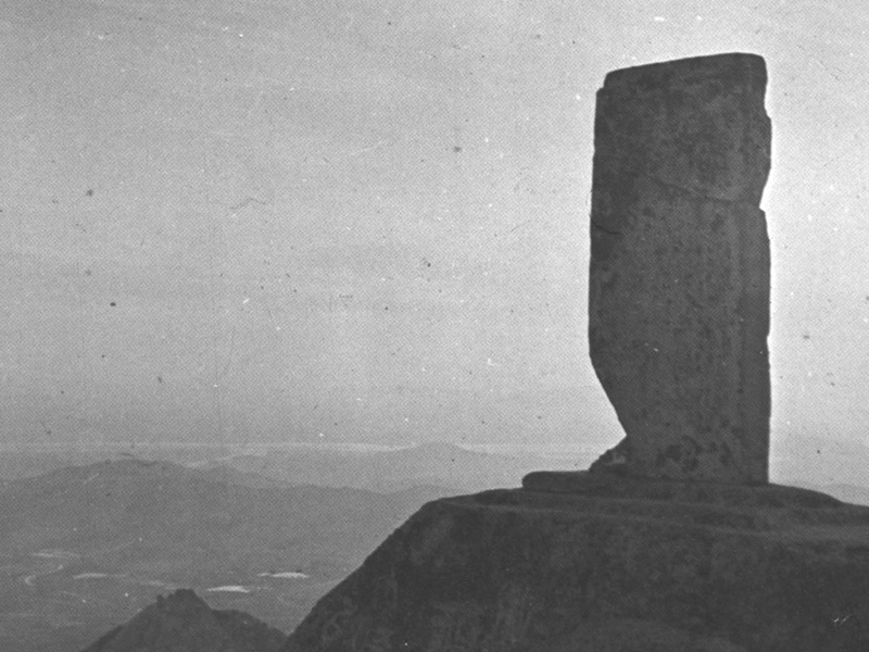
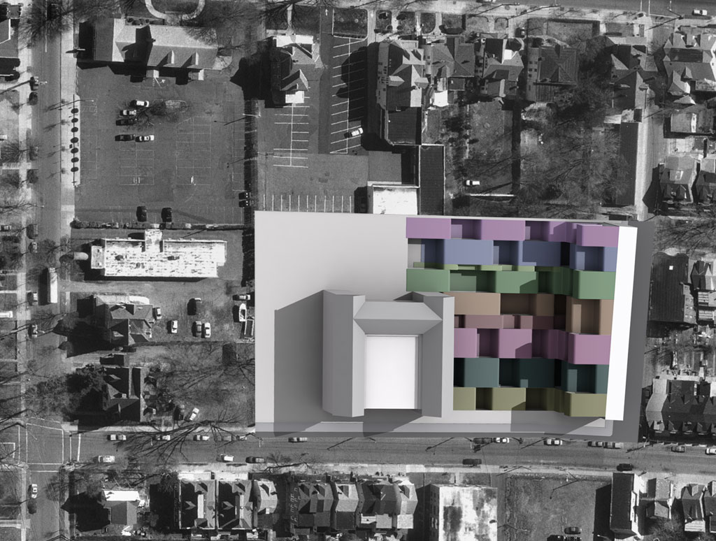
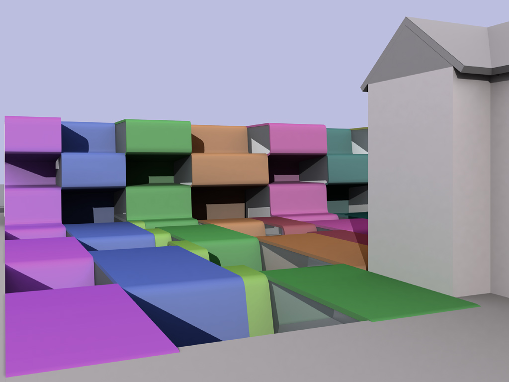
Korean Cultural Center
|
|
The museum layout, geometry and imagery is thematically quoted from a number of sources. In the context of the local internalized block structure, the lobby is a hub around which museum events are focused.The culture of Korea is represented by its national symbol, the Taeguk, manifested in the site plan. Its integration into LA ever present shifting tectonic plates occurs through a fracturing of the flag symbol, or a slot that penetrates the circulation ring and stops at the base of the tower. The tower, which houses the library and administrative offices, makes reference to the Pukhansan hunting monument from the Silla period overlooking Seoul. Continue reading Korean Cultural Center… |
Addition to the Prado
| The premise for this proposal is to make the collection and buildings comprehensible to a visitor within the contexts of culture, and time. The understanding of historical works must occur relatively, which requires providing information and making connections. Therefore, there are three critical factors which have to be continuously evaluated by the visitor; Culture, Structure and Information. Time and place are the primary concerns of the visitor ( how long they have and how they get around). Therefore the museum must provide a context for them. |
|
|
| Continue reading Addition to the Prado… |

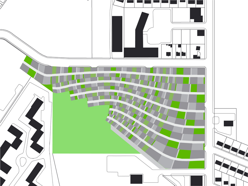
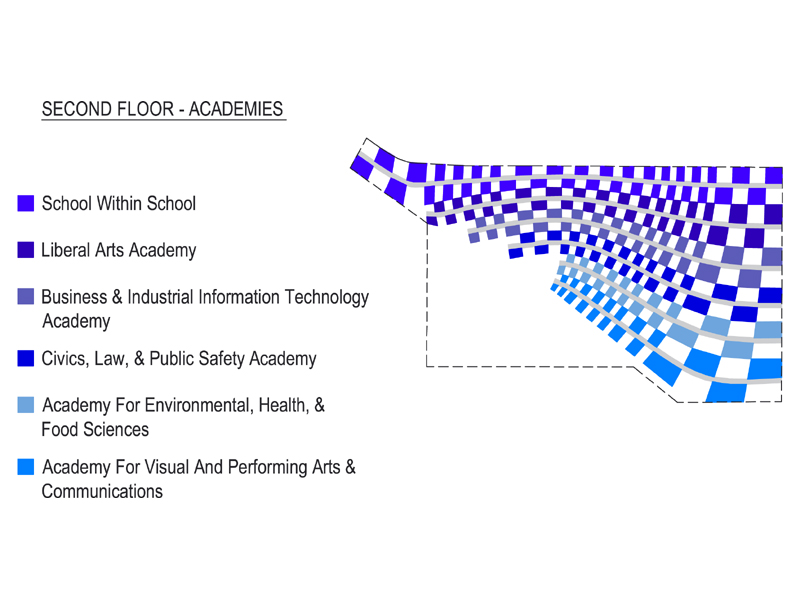
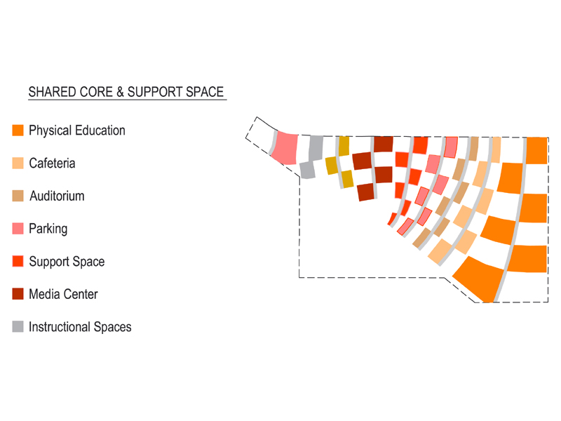
High School
|
|
Light, Air and Open Space were the priority in developing this scheme. The open matrix was used so that daylight and fresh air can penetrate the entire program, promoting a healthy and comfortable environment for learning.The site lends itself to separating the program into two levels; the Academies are located over the shared space so that all the common uses are easily accessible from all the learning spaces.The Academies are entered from Convery Boulevard, where the bus drop off is located. Bike courtyards are integrated into the open space beside the individual academic entrances and the Instructional Commons. Continue reading High School… |
Middle School
| The new 3 story structure was placed on the westerly edge of the site to maximize the playground located between it and the original school. The interior connection between is below grade so that the historic structure can be preserved without above ground interference. An open-space matrix was developed that would permit the majority of classrooms to be adjacent to the interior connection, below grade. The 3 school communities have their own discreet location but share the same general space, around the playground and function as parts of a single school community. The ribbon concept is used to unify the open space matrix, between the terraces in the 3 story structure and the courtyards on the ground. |
|
|
| Continue reading Middle School… |
Riverboat Terminal
|
|
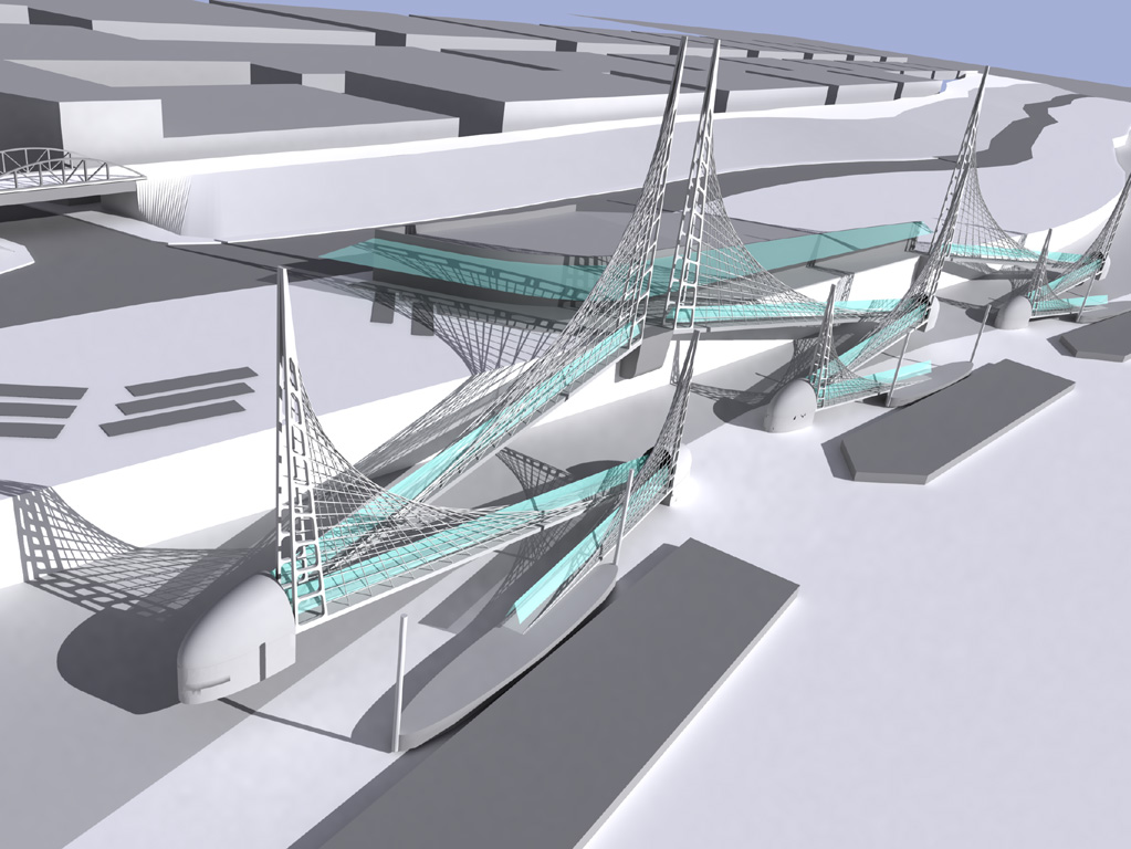
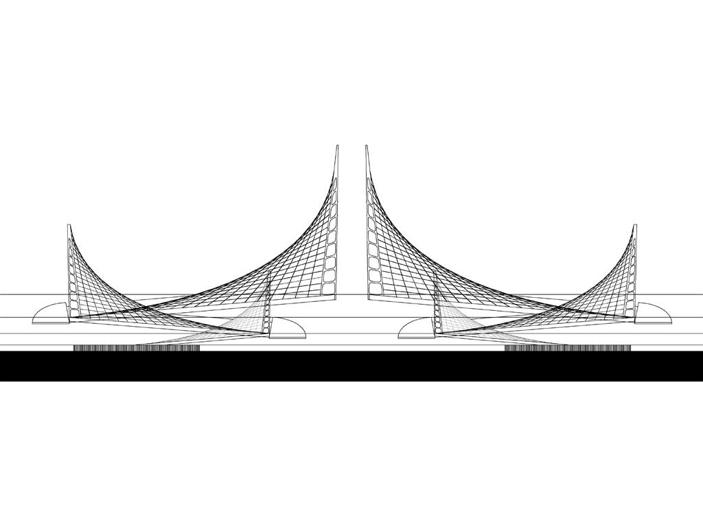
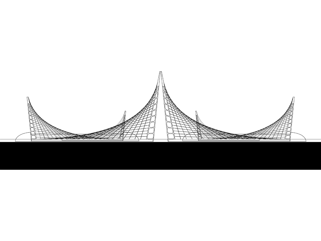
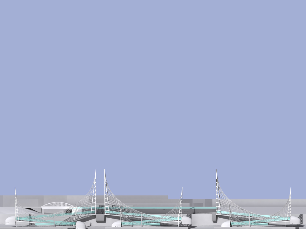
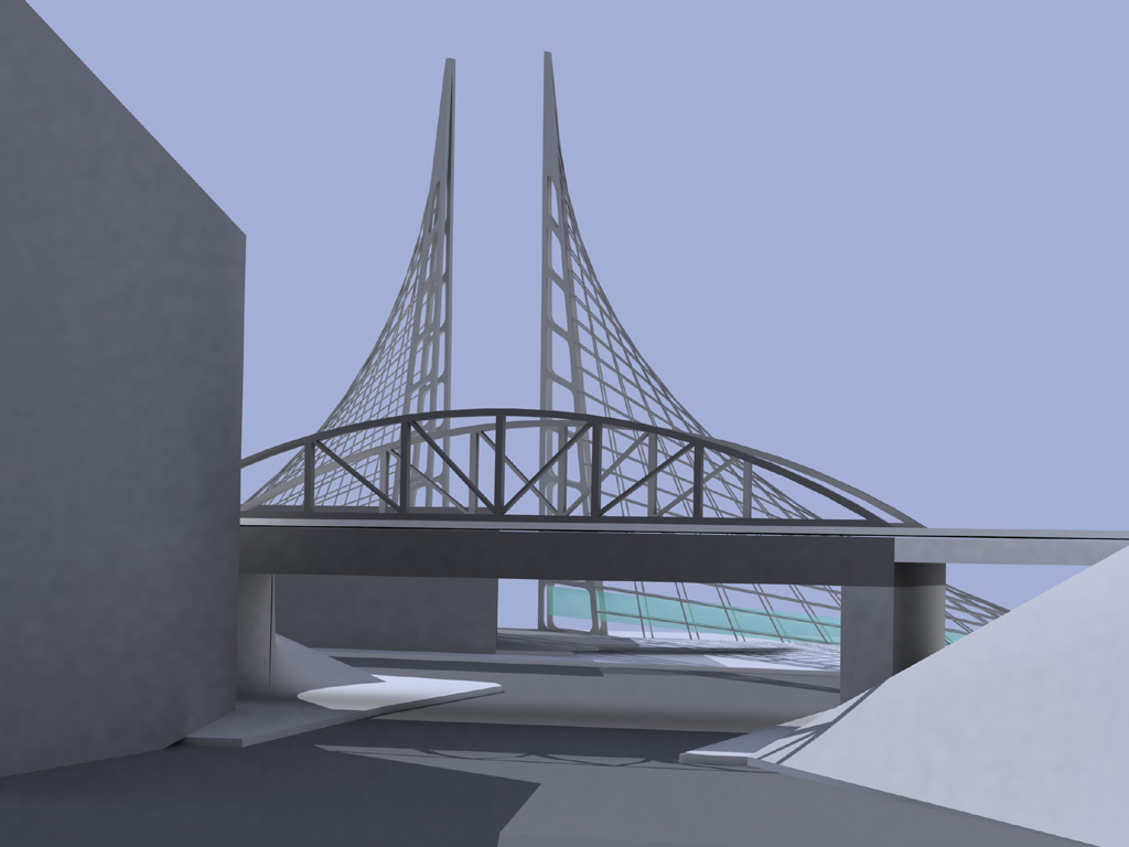
The Stage Gauge is designed as a landmark to terminate Beale Street that tracks the elevation of the river from month to month, day to day. The pontoon type marine facility makes use of the gangway structure to trace the movement of the river’s elevation. Collectively, the image of the gangway structures could be seen as a “flotilla of sails”. When the river stage is low, the sails appear to be in motion. When the river is high, the sails are static or calm. The gangway ramp lengths are designed to operate as accessible routes between river elevations from 230′ to 185′. This would allow the facility to be open over 95% of the time throughout the year. Continue reading Riverboat Terminal… |

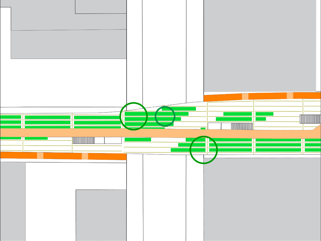
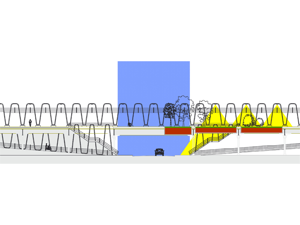
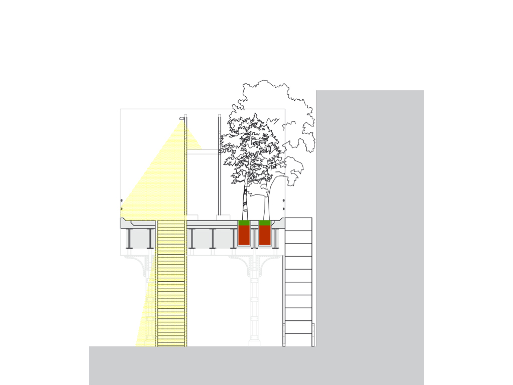
Highline Park Conversion
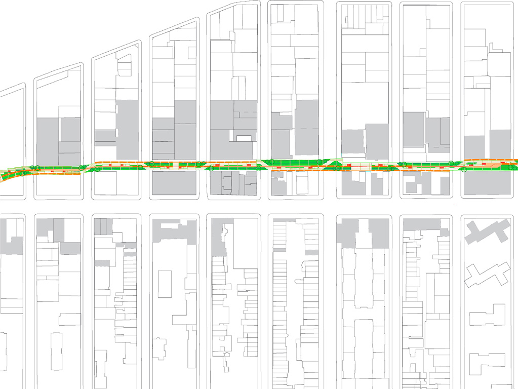
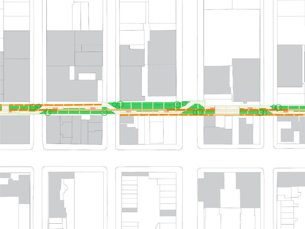
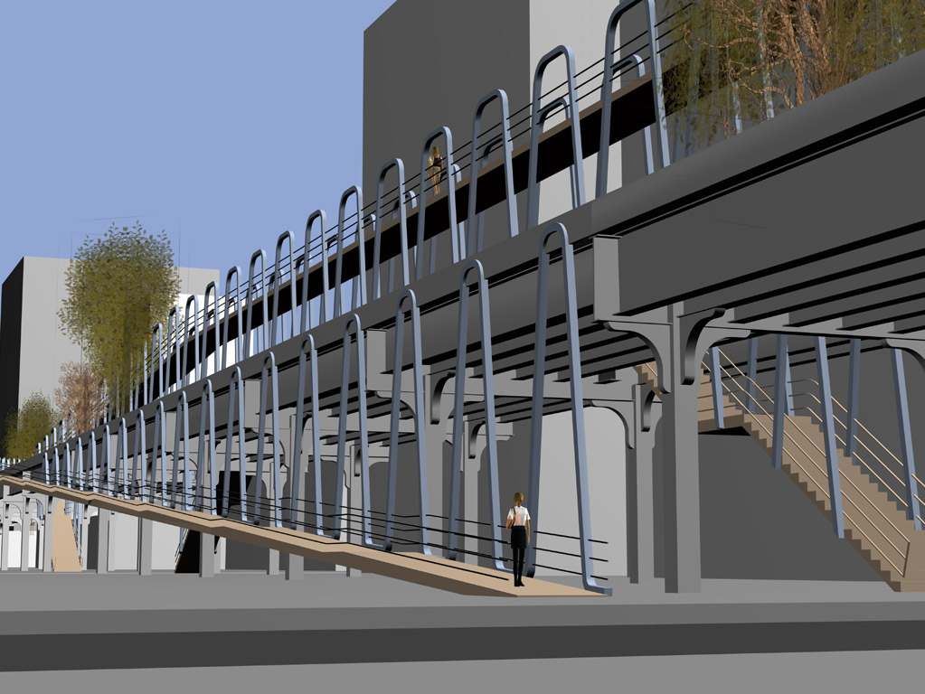
| European canals slice through their cities by connecting with each street they pass under. Now used as linear parks, they survive because they are inseparably connected to the urban system. The highline has to be connected to NYC’s street grid in a similar way to become an integrated and safe part of it. If the highline is thought of as a park in this way then it can become NYC’s Green Canal.A system of stairs and ramps establish a strong connection to the street grid. A stairway at each side of every street leads to the linear park to promote a safer urban environment. |
|
|
| Continue reading Highline Park Conversion… |
Left
| [slideshow id=”421″ href=”http://alastair01.webfactional.com/category/mixed use” image_size=”thumbnail” height=”215″ width=”287″ ] | CHANGE THIS TO A DESCRIPTION CHANGE THIS TO A DESCRIPTION |
Newer entries..... .....Older entries
© Standing Architecture